

Depaving & Aquifer Hydrology Master Plan
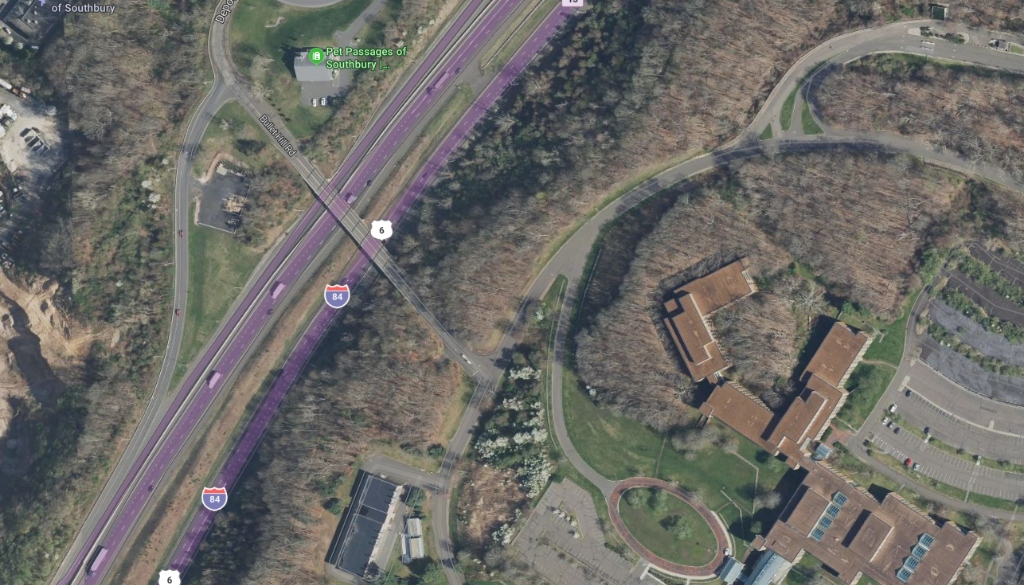
Reversing 40 years of suburban asphalt runoff. The master plan removes 380,000 SF (8.72 acres) of redundant impervious parking lots, transforming hot asphalt into native pollinator meadows, deep-root bioswales, and seasonal rain gardens that naturally recharge the Pomperaug aquifer.

Asphalt to Living Meadow
By eliminating the excessive parking lots engineered for 1980s solo commuters, we restore 8.72 acres to productive ecological meadow. Deep-rooted prairie grasses break up compacted soil and absorb torrential rain events.
Tiered Infiltration Swales
Rather than channeling stormwater into concrete pipes that overwhelm downstream culverts, run-off is redirected through terraced rock channels and vegetative bio-filters that capture sediments and recharge groundwater.
Pomperaug River Basin Safety
Per USGS hydrologic data, the 228-acre campus sits on an upland bedrock plateau with 98.3% of its watershed draining into the Pomperaug River system. Modern depaving stops localized erosion along Bullet Hill Road.
TR-55 Runoff Volume Comparison
All-Asphalt Impervious Lot
100% impervious asphalt flushes hot oil, rubber dust, and silt directly into road ditches and surface streams at high velocity, causing downstream riverbank scouring.
380k SF Depaved + Bioswales
70.4% reduction in peak surface runoff volume. 337,000 gallons per storm captured in permeable sub-base and restored meadows, recharging the town aquifer.
Net Clean Aquifer Recharge
Over Southbury's average 48 inches of annual rainfall, the project replenishes millions of gallons of naturally filtered clean water into the local water table.
Exceeds the updated Connecticut Department of Energy and Environmental Protection (DEEP) guidelines by maintaining zero net increase in peak runoff rate and integrating natural low-impact development (LID) throughout.
State Awards $1.29 Million to Southbury Land Trust for 148-Acre DuPont Farm
On June 23, 2026, Governor Ned Lamont and CT DEEP Commissioner Katie Dykes awarded $1,293,500 to the Southbury Land Trust (SLT) through the Open Space and Watershed Land Acquisition Grant Program (OSWA)—the largest state grant in SLT history. The grant preserves the 148-acre DuPont Farm along Hulls Hill Road in Southbury and Oxford, safeguarding four vernal pools, perennial springs, and headwaters feeding Eight Mile Brook while connecting Southford Falls State Park to a 340-acre Oxford open space parcel.
Direct Civic Alignment: Kettletown's civil master plan operates on this identical conservation ethos. By depaving 8.72 acres (380,000 SF) of redundant asphalt and dedicating 200+ acres of its 228-acre parcel to permanent conservation easements and arboretum trails, Kettletown recharges 5.17M–7.85M gallons annually into the Pomperaug aquifer basin while reinforcing Southbury's regional open space corridors.
*(Note: Regional conservation projects are cited as planning benchmarks; the Southbury Land Trust has not reviewed or endorsed this civic concept.)*
Download the Hydrology & Depaving Study
Receive the technical hydrology briefing outlining TR-55 stormwater runoff methodologies, aquifer recharge models, and CT DEEP stormwater compliance framework.